
Für eine deutsche Übersetzung dieser Seite einfach die Brandenburger Flagge anklicken
 |
Click the Brandenburg Flag for a German translation Für eine deutsche Übersetzung dieser Seite einfach die Brandenburger Flagge anklicken |


 |
Home TownsManteca, California |
 |


|

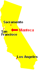
Our home town Manteca is located in the heart of California's Central Valley. Until the 1970s, it was a small agricultural town, hardly worth mentioning. In the 1970s, the rise of housing prices in the San Francisco Bay Area caused many workers to look eastward for a cheaper place to live or a better place to raise their families. Since the construction of the 120 bypass portion of State Route 120, Manteca has become a popular choice for these commuters and today, a large part of Manteca's population makes a living by commuting to the Bay Area. Manteca isn't really blessed with any sights, but there is one thing we really like: The Manteca Mural Project. Since 2003, several artist have painted eleven larger than life murals all over the town and we are going to use some of them to tell the history of our home town. |
|


Manteca's History - told by its Murals |

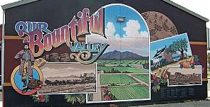
The mural "Our Bountiful Valley" depicts a lot of Manteca's early history. The
Yokut people, who lived here for 4,000 are represented
by one of their artistically woven baskets. Also honored are French-Canadian fur-traders who came here every summer from about 1832 and were the first "white" settlers in the area.  The center part of the mural is dedicated to Manteca as a center of early agriculture. Today, California's farms provide 15% of the world's food supply. |
|

Following the Canadian trappers were Mormon pioneers, who first came to the area in 1847. Then, the Gold Rush brought more settlers.
Later, in 1861, 19 year-old Joshua Cowell arrived and bought 1,000 acres in what is now downtown Manteca. Cowell, the "father
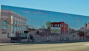
of Manteca," became Manteca's first mayor, when the town was incorporated in 1918. The corner of Main Street and Yosemite Avenue, now the center of Manteca, was once the center of Joshua Cowell's estate. The mural Crossroads depicts the intersection as it was in 1918. |
|

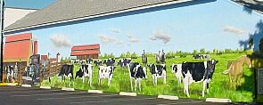
| The mural Community Dairy, also nicknamed "Cow-Muh-Nity" commemorates the importance of dairy farms in Manteca's history. It is situated at the location of Manteca's first business, "The Creamery." This dairy was so successful, that in 1911 it received its own railroad stop. The stop was supposed to be called Monteca (Spanish for cream) but a railroad-misprint turned it into Manteca (Spanish for lard). The error was never fixed and for the last 100 years, our town has been called "Lard." |
|

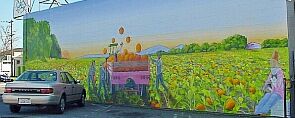
In addition to alfalfa and almonds, one of Manteca's earliest crops was pumpkin. Today, Morton, IL may claims the title "Pumpkin Capital" for the
fact that 90% of America's canned pumpkin puree is produced there, but for over 100 years, Manteca had the highest yields per acre in every
pumpkin harvest. The mural Pumpkin Harvest honors Manteca as America's true Pumpkin Capital - and we have the festival to prove it! |
|

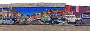
In the 1950s and 60s, modern times reached Manteca. Manteca Cruise
is Manteca's largest Mural and was dedicated in 2008. The mural depicts Manteca's favorite 1950s past time: car cruising. Some of the local legends of the time are also immortalized in the painting. |
|


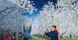
For the last 70 years, almonds have been one of the major crops of Manteca's agriculture. Lately, many of the old orchards have been sacrificed
to new housing developments, but a number of them still remains, creating two very special weeks every spring. The almond blossom season has been commemorated in one of Manteca's latest murals, called Manteca Snow. |
|

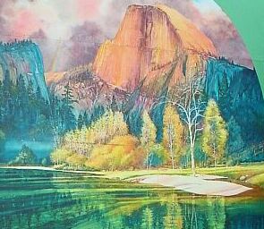
Finally, there are two murals on Yosemite Avenue, one facing east and one facing west. Golden Gateway to Manteca and Sierra's Crown highlight Manteca's location in the Heart of California.  From here it is about one and a half hours to San Francisco (driving west) and the same one and a half hours to Yosemite (driving east). |
|


|
And here are a couple of links to some of the special events we documented. At the bottom of the list you find a link to our new home.  


|