
Für eine deutsche Übersetzung dieser Seite einfach die Brandenburger Flagge anklicken
|
|
Click the Brandenburg Flag for a German translation Für eine deutsche Übersetzung dieser Seite einfach die Brandenburger Flagge anklicken |

|
|
EarthA collection of early pictures of our home planet,
|
|

|
Here are our favorite pictures of the Earth. Juri Gagarin coined the term "Blue Planet," but it took a few more years, before humanity could take a look at the entire planet in its blue beauty. The first colored picture of the entire Earth was taken in July 1967 by the American satellite DODGE (left), but it was neither the first, nor the last picture of Earth taken from space. The first attempts of taking pictures of the earth from (somewhat) far away were made during balloon flights in the 1930s. followed by pictures taken by ballistic rockets in the 1940s. The colored ball in the bottom of the picture left was intentionally placed there to identify colors. Source:www.donaldedavis.com |
First High Altitude Pictures |
| The first time people got a real view at the Earth "from outside" was during high-altitude balloon flights conducted in the Soviet Union and in the USA in the 1930s. On November 11, 1935 the American baloon Explorer II reached a record altitude of 72,395 feet (22,066 m). During this flight, Lt. Col. Albert W. Stevens took the first picture showing the curvature of the Earth. |

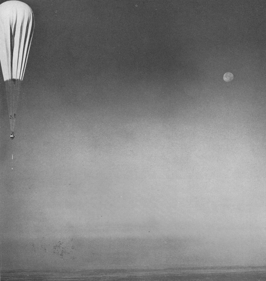 Explorer II and the full moon Source: National Geographic / stratocat.com |
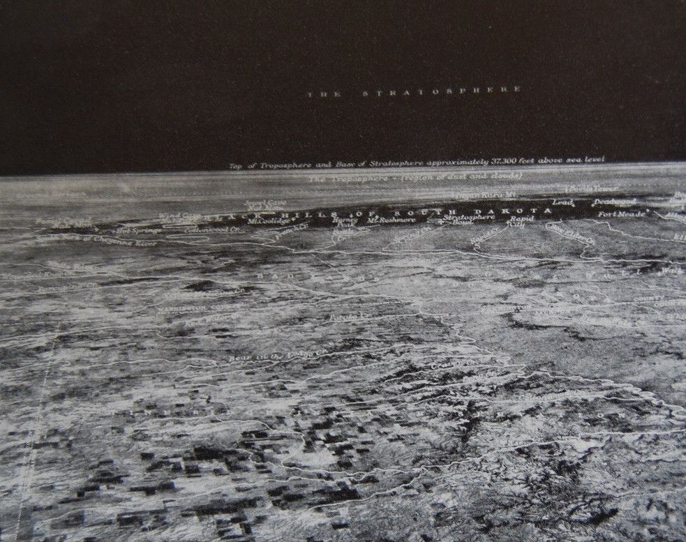 Black Hills from 72,395 feet - the first photograph showing the curvature of the Earth. Source: historicaltimes.tumblr.com |
First Pictures from Space |
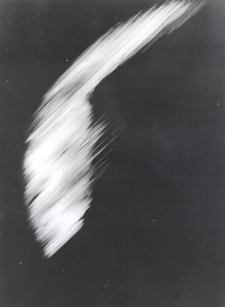
| In April 1946, the Upper Atmosphere Research Panel began test launches of captured German V-2 rockets from White Sands Missile Range. On October 24, 1946, a V-2 rocked reached an altitude of 65 miles (104.6 km) and took the first picture of Earth from outer space. |
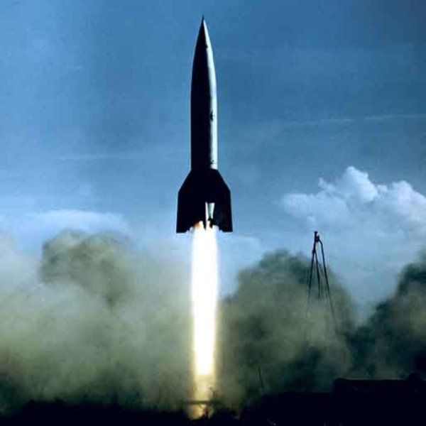 Launch of a V-2 rocket in White Sands Source: Air&Space |
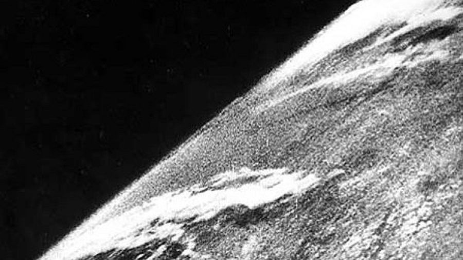 The first photo of earth from space Source: Air&Space |
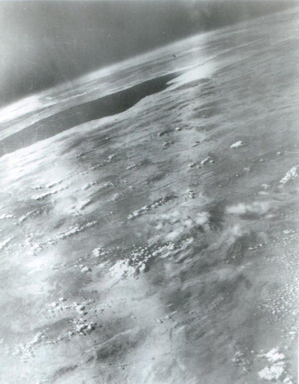 Gulf of California from 101 miles up. March 7, 1947 Source: Air&Space |
First Pictures taken in Earth Orbit |
|
Sputnik didn't have a camera and neither did the first American satellite. The first picture of earth taken by a satellite was beamed to earth on
August 14, 1959 by the American probe Explorer 6. Not even a year later, weather satellite
TIROS 1 delivered the first television images. The first pictures sent to Earth electronically did not have a very high resolution. That's why spy satellites sent film capsules directly back to earth, delivering the first high resolution images. On August 10, 1960, the capsule of Corona 13 became the first object recovered from space. Most of these pictures are still classified, but a picture of the Pentagon, taken in 1967 demonstrates the quality of the Corona images. |
|
Explorer 6 Source: colostate.edu 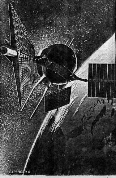
|
TIROS 1 Source: cecom.army.mil 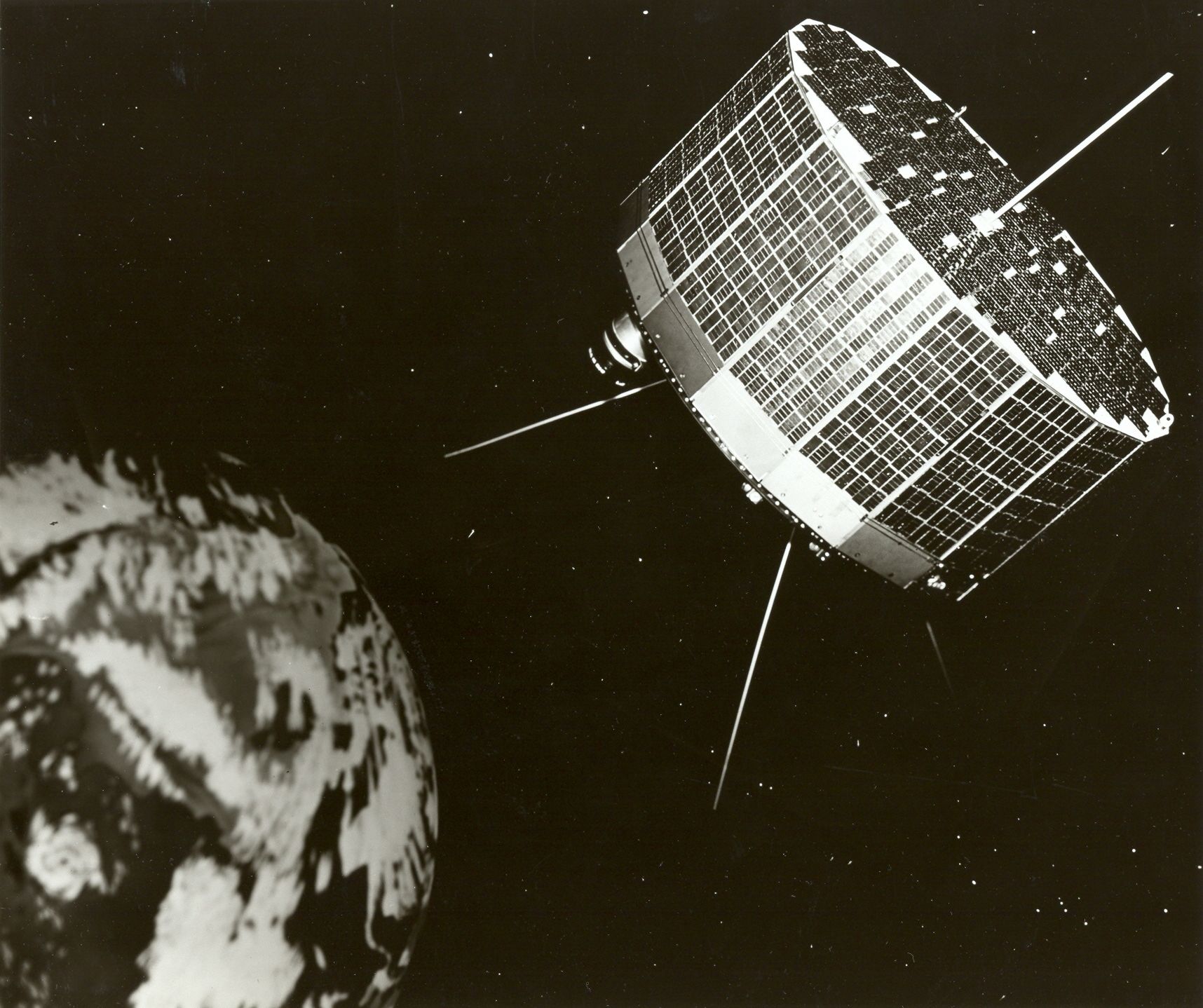
|
Corona Satellite Source: noticiasdelmisterio.com 
|
 The first picture taken by a satellite. Explorer 6. Clouds over the Pacific Ocean, August 14, 1959 Source: 3bmeteo.com |
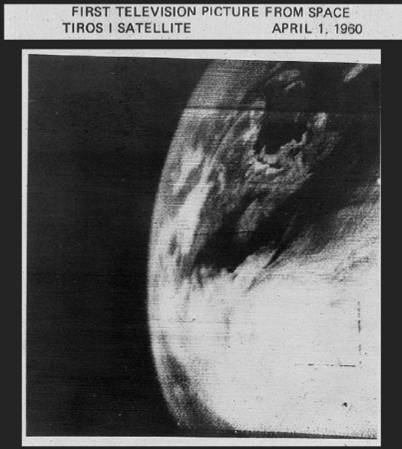 The first television image of Earth from orbit. TIROS 1, April 1, 1960 Source: 3bmeteo.com |
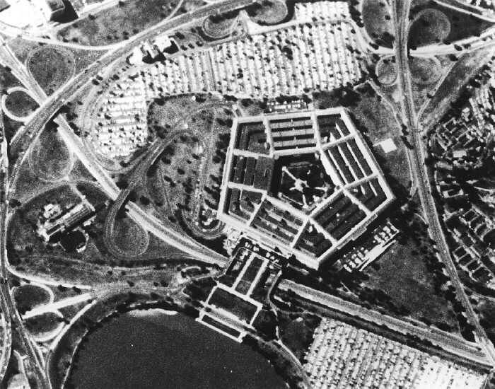 Declassified Corona image of the Pentagon, September 25, 1967 Source: Wikipedia |
First Pictures of the entire Earth |
|
The Soviet Molniya communications satellites did not only provide military communication and TV coverage to remote areas of the Soviet Union.
Their highly eccentric elliptical orbits also allowed them to take pictures of global cloud coverage. On May 30, 1966, Molniya 1-3 took the first distant picture of the Earth, showing the entire planet for the first time.
|
|
Molniya 1-3 Source: spaceflight101 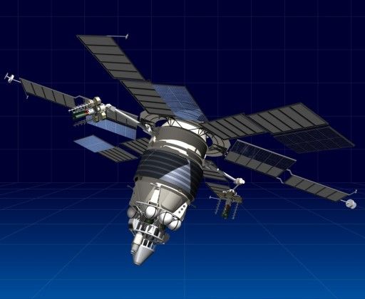
|
DODGE Source: Gunter Krebs 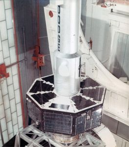
|
ATS-1 Source: NASA 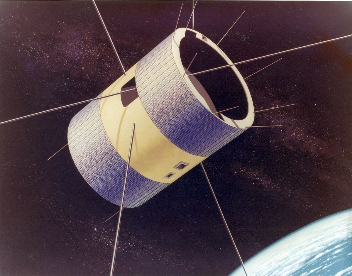
|
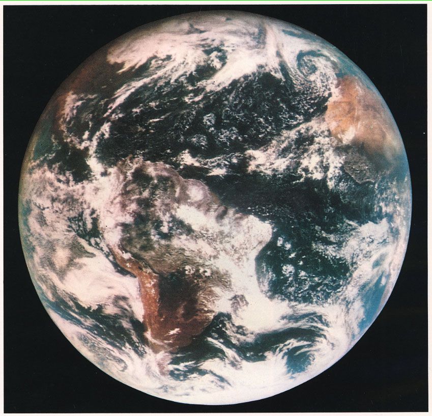
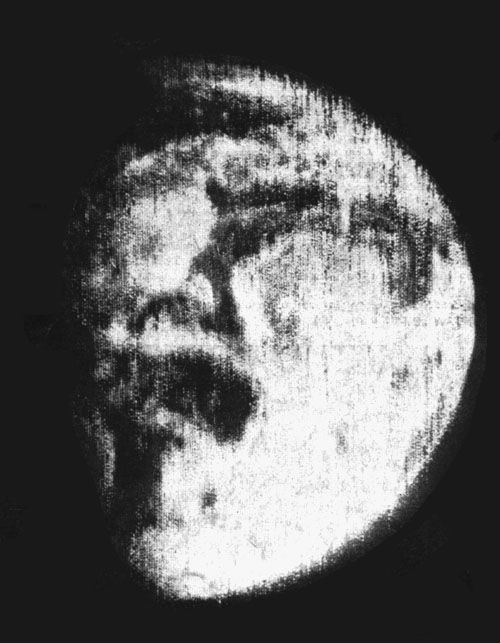 The first picture of the entire Earth Molniya 1-3, May 30, 1966 Source: Don Davis |
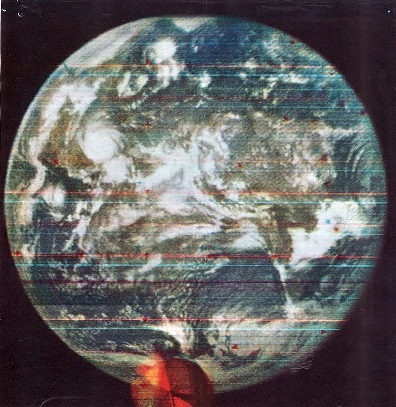 First color picture of the entire Earth DODGE, July 1967 Source: Wikipedia |
 First high definition color television images of the entire Earth, ATS-1, November 18, 1967 Source: Don Davis |
|
The first color image, showing earth as a disk was taken in July 1967 by the American satellite DODGE, a
satellite testing geosynchronous orbit technologies. On November 18, 1967, another American technology test satellite, ATS-1,
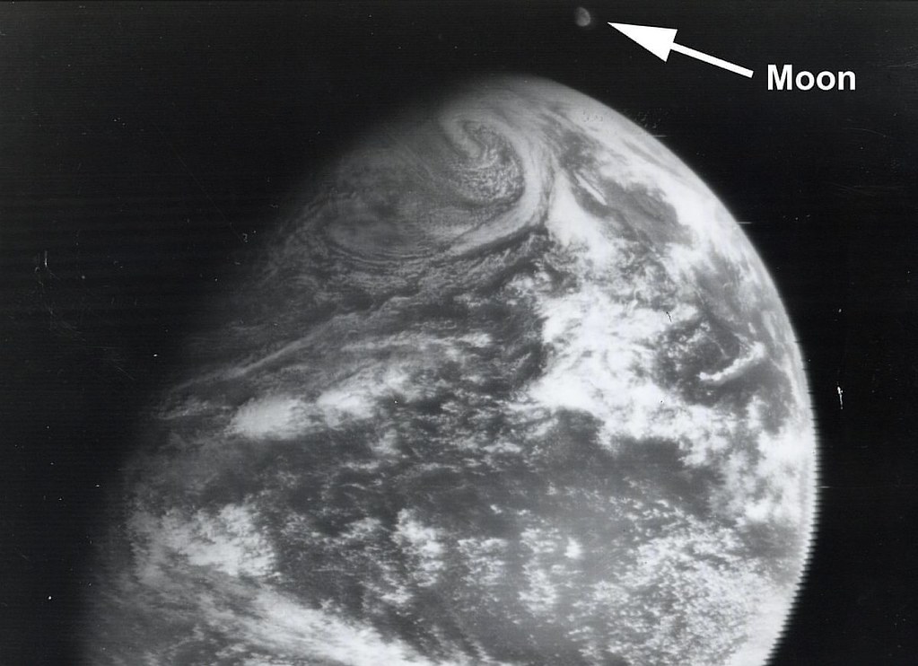
delivered the first high definition color television images of the entire Earth. On December 22, 1966, DODGE took the first picture ever showing the Earth and the Moon together. (Source: NASA) |
|
 |
XXXPictures taken at the International Space Station The International Space Station is humanity's outpost in Earth orbit. The station's Cupola is an ideal spot to observe and photograph the Earth. During his stay in 2012/13, Canadian astronaut Chris Hadfield took 48,000 pictures and published many of them on his Twitter account. From there, many of his pictures made it onto the internet. We put together a colection of our favorite shots. |
|
|
Click here to fly back to Venus | Click here to see the Earth from the ISS |
|
|
Back to Solar System Page |
Back to Space Page |
Back to English Main Page |
 Back to Start Page |
#/media/File:Corona_pentagon.jpg)
.png)