
Für eine deutsche Übersetzung dieser Seite einfach die Brandenburger Flagge anklicken
 |
Click the Brandenburg Flag for a German translation Für eine deutsche Übersetzung dieser Seite einfach die Brandenburger Flagge anklicken |


|
|
MarsA collection of pictures of Mars,
|
|


 |
For as long as there have been telescopes, people have been observing Mars. But while we found a number of very early drawings, it seems like
there are no early photographs. To the left is an image taken by the Hubble Space Telescope on August 27, 2003 at 9.35 UTC, when Mars had just made its closest approach to Earth in nearly 60,000 years. Here are our favorite orbital pictures of Mars. Like our other space galleries, the pictures have not been selected because of their scientific significance but because of their esthetic value and sometimes because of their historical importance. Source: skyimagelab.com |


  Huygens August 13, 1672 |
  Bianchini 1719 |
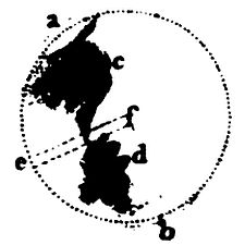  Herschel late 1770s |
  De la Rue April 20, 1876 |

Early Drawings |
 |
The first one to point a telescope at Mars was no other than Galileo in 1610. But the
resolution of his telescope was not good enough the see surface features. The first drawings with distinct features were done between 1659 and 1672
by Christiaan Huygens, who sketched a surface feature that was 330 years later identified
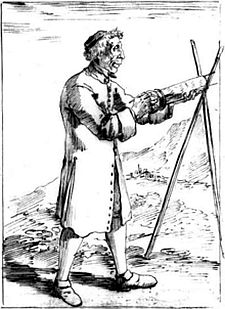
as the Syrtis Major Planum, a dark area in Mars' northern hemisphere. In 1719, Francesco Bianchini, using a refractor of 6.4 meters focal length (picture left), draw an image of an area that was mostlikely what is now known as Terra Sabaea. His observations were followed by drawings done by William Herschel, the discoverer of Uranus. Some of the most detailed drawings of the late 19th century were done by Warren De la Rue. All images above are from a study done at Harvard. Another extensive study on the subject was done by Camille Flammarion. In 1867, Richard A. Proctor produced one of the first complete maps of Mars. Some of the names he used in his map are still in use today. Another famous map, done by Percival Lowell in 1894 gave rise to the long and controversial debate of the Martian Canals. |

 Martian Map by Richard A. Proctor, 1867 Souce: harvard.edu |
 Map of Martian Canals by Percival Lowell, 1894 Source: wanderer.org |


|
First attempts to send a probe to Mars were made by the Soviet Union in 1960, just one year after a number of succesful moon missions. After three launch
failures, Mars 1 was sent towards the Red Planet on November 1, 1962, but communication failed, before the
probe would pass Mars. The first succesful flyby was carried out by NASA's Mariner 4, which passed Mars on July 15, 1965 in a distance of 9,846 kilometers (6,118 miles) and beamed the first pictures back to Earth. An extensive story about the first pictures can be found here. The pictures were grainy and low resolution, but they were the very first closeup images of a world that humans could not observe with the naked eye. Therefore the images were celebrated with the same enthusiasm as 50 years later the first pictures from Pluto. Two more flybys took place in 1969, when the twin probes Mariner 6 and 7 passed Mars in a distance of just 3,431 kilometers (2,132 miles). |
  New York Times, July 15, 1965 Source: NYTArchives |

  Artist's impression of Mariner 4 passing Mars Source: youtube |
  First closeup picture of Mars, July 15, 1965 Source: NASA |
  Cratered surface in Memnonia Fossae Source: NASA |


|
On November 14, 1971 the US probe Mariner 9 entered Martian orbit and became the first satellite in orbit
of another planet. Among the most impressive pictures taken by the probe was one of Olympus Mons, the tallest volcano and the second tallest mountain in the solar system. Soviet probes Mars 2 and Mars 3 entered orbit shortly after Mariner 9. |
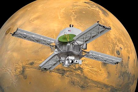  Artist's impression of Mariner 9 in Mars orbit Source: realspacemodels.com |
  Olympus Mons, January 9, 1973 Source: artnet.com |


|
The Soviet probes didn't take pictures as their primary mission was to deploy landers for the first landing on Mars. In the last 40 years, a whole fleet of spacecraft has orbited Mars or landed on the planet, making Mars the most photographed object in space other than Earth. Pictures from the surface of Mars will be part of the next chapter. Here are some of the most notable orbiter missions: . NASA's Mars Global Surveyor entered Mars orbit on September 12, 1997 and was operational for seven years, producing a map of the entire planet. NASA's Mars Odyssey has been in orbit since October 24, 2001 and is still operational. Its main task is to detect evidence of past or present water and ice on Mars. ESA's Mars Express, in orbit since December 25, 2003 is also still operational, performing high-resolution imaging and mineralogical mapping of the surface. NASA's Mars Reconnaissance Orbiter entered Mars orbit on March 10, 2006. It has delivered some of the most impressive high resolution images and continues to analyze the landforms, stratigraphy, minerals, and ice of Mars. On September 24, 2014, India became the fourth nation to reach the Martian orbit. Mangalyaan, officially called "Mars Orbiter Mission", is mainly a technology mission, testing hardware for future projects. Two other probes, MAVEN and ExoMars Orbiter have been in orbit since 2014 and 1016, respectively. NASA's "Mars Atmosphere and Volatile EvolutioN" has the specific task to investigate, how the planet's atmosphere and water, presumed to have once been substantial, were lost over time. The "ExoMars Trace Gas Orbiter", a joint project between Russia and ESA investigates methane and other trace gases present in the Martian atmosphere that could be evidence for possible biological activity. |

|
Here are some of our favorite pictures, taken by these orbiteres: Mars Global Surveyor |
  Artist's impression of Mars Global Surveyor in orbit Source: Wikipedia |
  Color image of Olympus Mons, October 20, 1997 Source: NASA |
  "Happy Face" in Galle Crater, March 1999 Source: Malin Space Science Systems |


| Mars Express |
  Artist's impression of Mars Express in orbit Source: planetary.org |
  Composite image of Korolev crater’s filled with ice deposits, January 5, 2019 Source: thespaceresource.com |

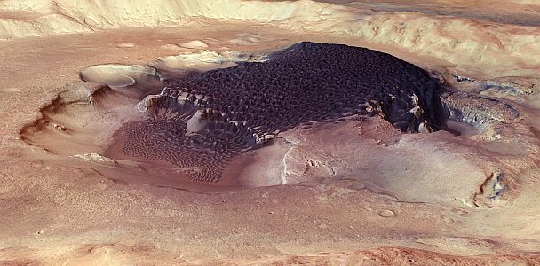  Rabe crater, 2014 Source: Wikipedia |
  Ice on the south pole, 2015 Source: Wikipedia |


| Mangalyaan |
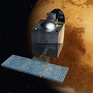  Artist's impression of Mangalyaan in orbit Source: Wikipedia |
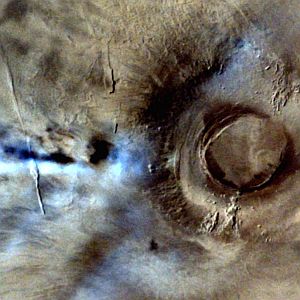  Clouds over Arsia Mons, January 4, 2015 Source: ISRO |
  Pital Crater, April 23, 2015 Source: ISRO |


| Mars Reconnaissance Orbiter |
  Artist's impression of Mars Reconnaissance Orbiter Source: space.com |
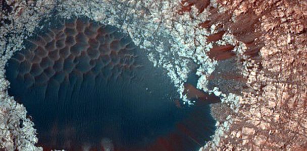  Slopes and Dunes, April 3, 2019 Source: NASA/JPL/University of Arizona |

  Frozen carbon dioxide Source: NASA/JPL/University of Arizona |
  New impact crater, formed between 2010 and 2012 Source: NASA/JPL/University of Arizona |
  Cliffs and high buttes, March 20, 2017 Source: universetoday.com |

|
For a lot more pictures, check out the JPL Photojournal and the
HiRISE Image Catalog. For some impressive paintings inspired by Mars orbiter photographs, check out the Mars Art Gallery. |


|
|
Click here to go back to the Apollo Program | Click here to move on to the surface of Mars |
|

|
Back to Solar System Page |
Back to Space Page |
Back to English Main Page |
 Back to Start Page |