
Für eine deutsche Übersetzung dieser Seite einfach die Brandenburger Flagge anklicken
|
|
Click the Brandenburg Flag for a German translation Für eine deutsche Übersetzung dieser Seite einfach die Brandenburger Flagge anklicken |

|
|
VenusA collection of pictures of the planet Venus,
|
|
 |
Here are our favorite pictures of Venus.
Like our other space galleries, the pictures have not been selected because
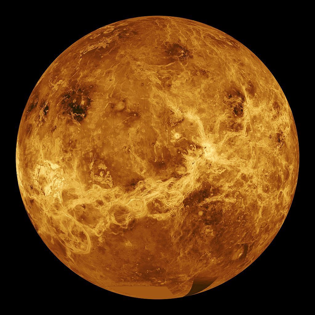
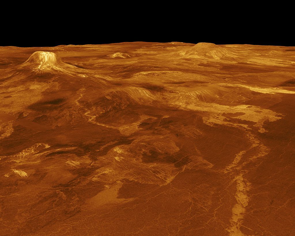
With an average surface temperature of 863 °F, Venus is the hottest planet in the solar system. That and its thick layer of clouds made of carbon dioxide
and sulfuric acid, make pictures from the planet's surface almost impossible. Only through radar observation did we get an idea of the surface. The picture
to the left is a composit of radar images taken by the Magellan probe between 1990 and 1994.
|
|
The first flybys were conducted by the Soviet Probe Venera 1 in 1961 and the American probe
Mainer 2 in 1962. But it wasn't until 1974, that Mariner 10 delivered the first pictures. Mariner 10 was launched on November 3, 1973 and passed Venus on its way to Mercury on February 5, 1974. |

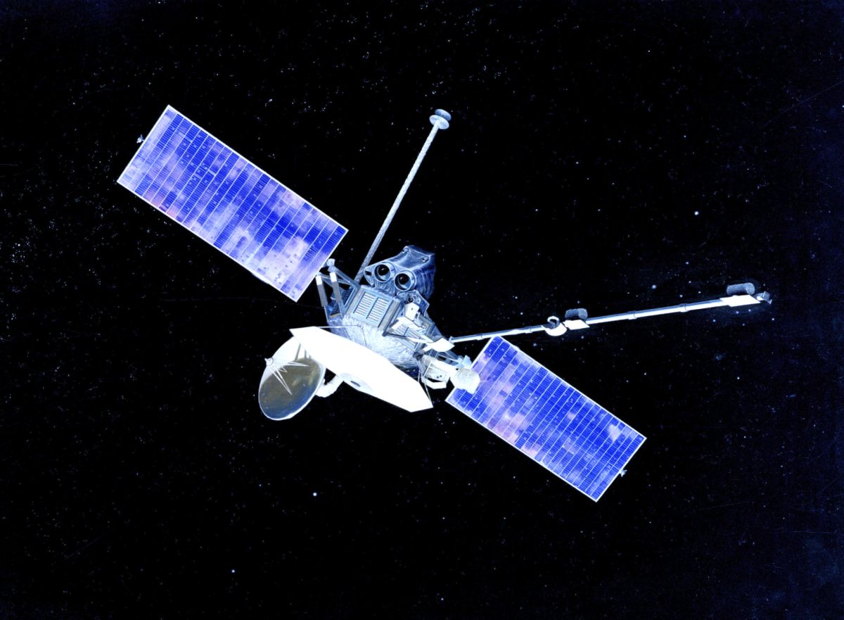 Mariner 10 |
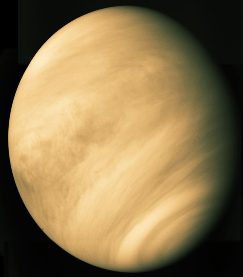 Real color image of cloud cover Source: University of Virginia |
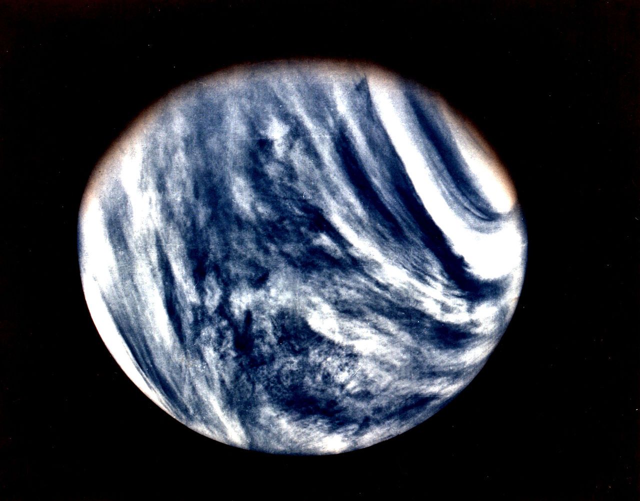 Enhanced color image taken in the UV spectrum Source: Wikipedia |
 Artist's impression of a Venera lander |
 Beta Regio; the first picture from the surface of Venus. Source: NASA |
|
The Soviet probe Venera 9, reached the planet on October 22, 1975. It was the seventh object
to reach the surface and the first one to keep functioning long enough to send back a picture - though only one. On March 1, 1982 Venera 13 landed on Venus and sent the first and so far only colour images from the surface. |
 Artist's impression of a Venera lander |
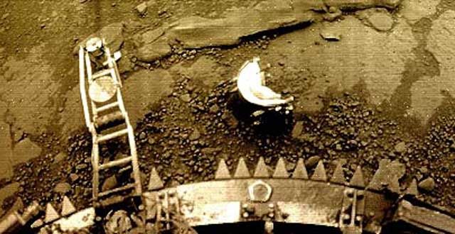 The first colour picture from Venus Source: sci-news.com |
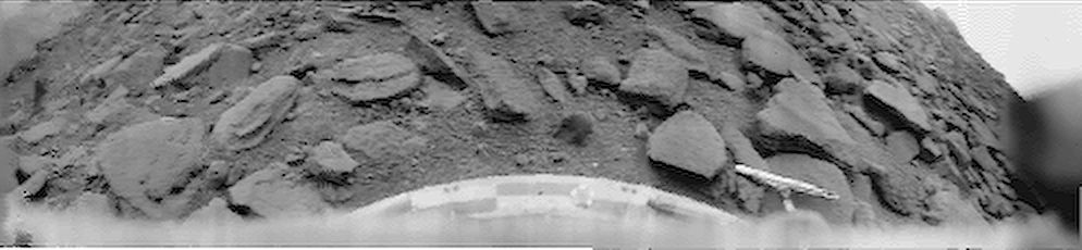
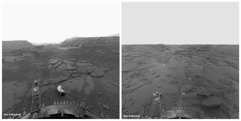 Phoebe Regio Source: Don P. Mitchell |
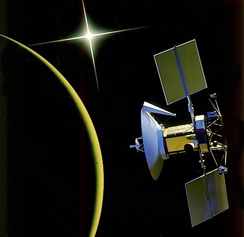 Artist's impression of the Magellan orbiter |
 Radar image of Gula Mons and Eistla Regio Source: Wikipedia |
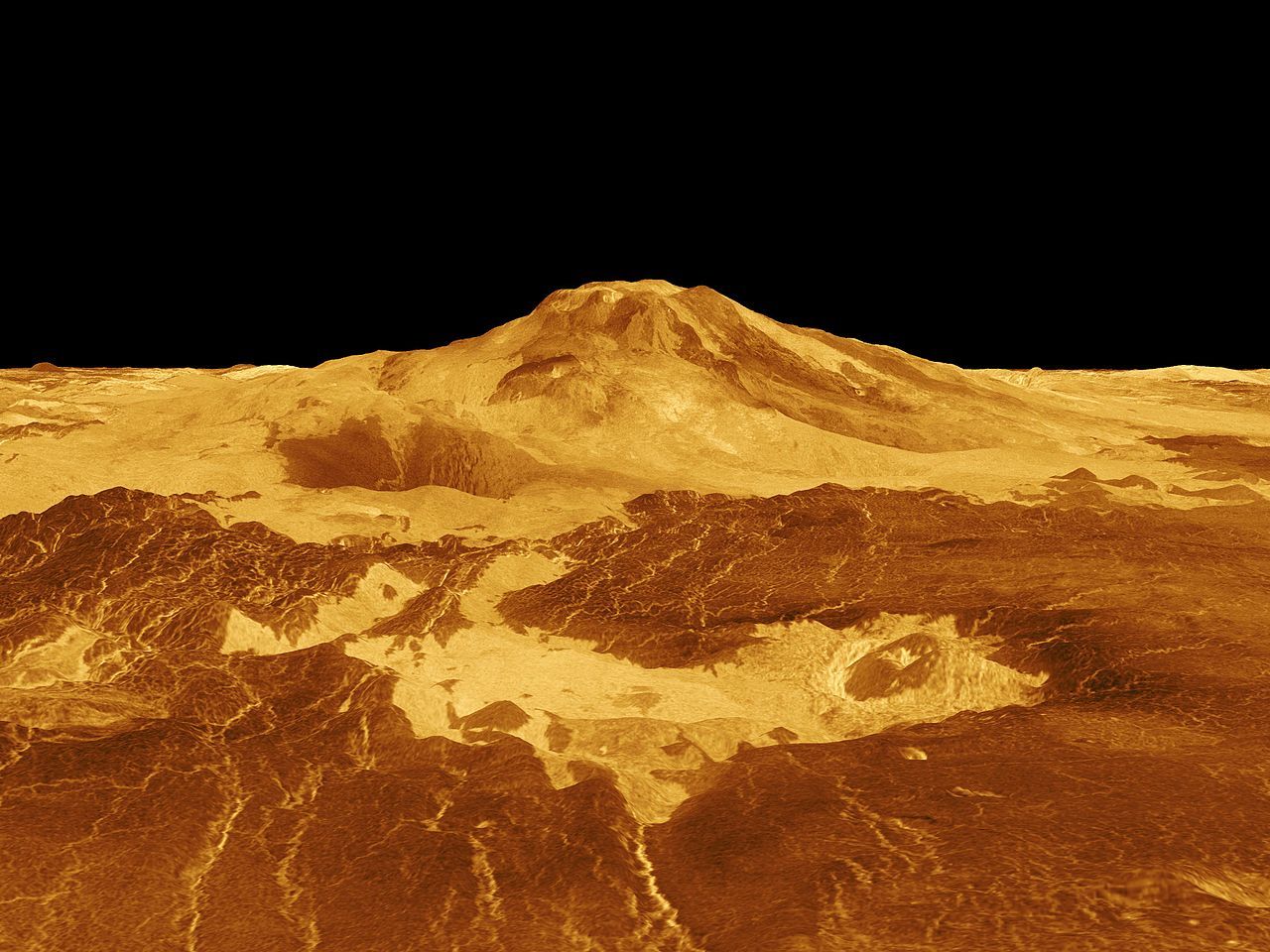 Radar image of Maat Mons Source: Wikipedia |
| It wasn't until the launch of the Magellan space probe that humankind got a better idea of what the surface of Venus was like. Magellan was inserted into an orbit around the planet on August 7, 1990. Over the course of the next four years, the probe mapped the entire planet using radar. Magellan burned up in the Venusian atmosphere on October 13, 1994. |
| Venus Transits |
|
Every 243 years, people on earth are able to observe a
Venus Transit - the passing of the planet in front of the sun. These transits were
essential for calculating the size of Venus and the Sun and the distance from the Earth to the Sun.
In 1769, Captain James Cook had to sail to Tahiti to observe the transit. 243 years later, in 2012, astronomers were aided by two space crafts. Here are pictures of the 2012 transit, observed by the SDO and the Hinode probes. |
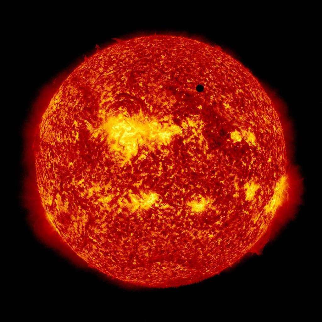 2012 Venus Transit as observed by SDO Source: Wikipedia |
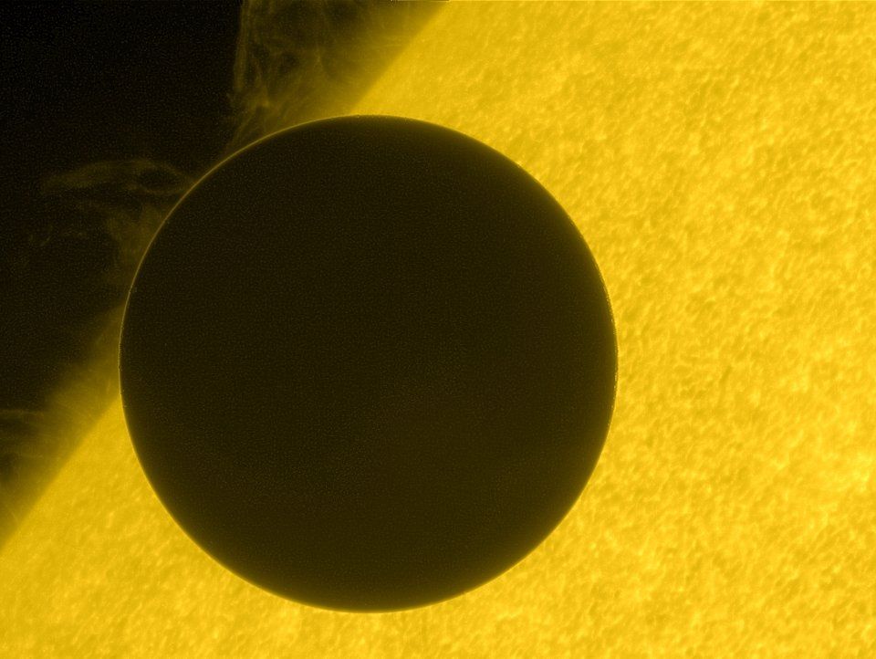 Closeup of 2012 Venus Transit as observed by Hinode Source: Wikipedia |
|
|
Click here to fly back to Mercury | Click here to move on to Earth |
|
|
Back to Solar System Page |
Back to Space Page |
Back to English Main Page |
 Back to Start Page |