
|
|
Star LoreThe Globes, Maps and Constellations
|
|
Dutch-Flemish astronomer and cartographer Petrus Plancius is credited with three of the
88 Constellations the
International Astronomical Union adopted in 1922. But his influence on
the mapping of the night sky goes far beyond the constellations
Columba,
Camelopardalis and
Monoceros.
 Petrus Plancius was one of the most prolific and most influential cartographers of his time. As one of the founders of the Dutch East India Company, he drew over 100 maps and trained the pilots of the First Dutch Fleet bound for the East Indies to make astronomical observations during their journey. Plancius designed a total of ten new constellations, three of which were adopted by the IAU in 1922. He also initiated the development of the Southern Cross as an independent constellation and was the first to put the twelve new constellations observed by Dutch navigators Keyser and de Houtman on a map. With that, Plancius is directly or indirectly responsible for sixteen of our modern constellations - a record surpassed only by Ptolemy. In 1589, Plancius worked with Dutch cartographer Floris van Langren, on the first globe that showed the Southern Cross and an independent constellation.
|
 Petrus Plancius; Wikipedia
|
|
The globe also displayed the Magellanic Clouds (though without a lable) and a
Triangulus Antarcticus, a star formation
observed by Italian navigator Amerigo Vespucci, but most likely put in the wrong place.
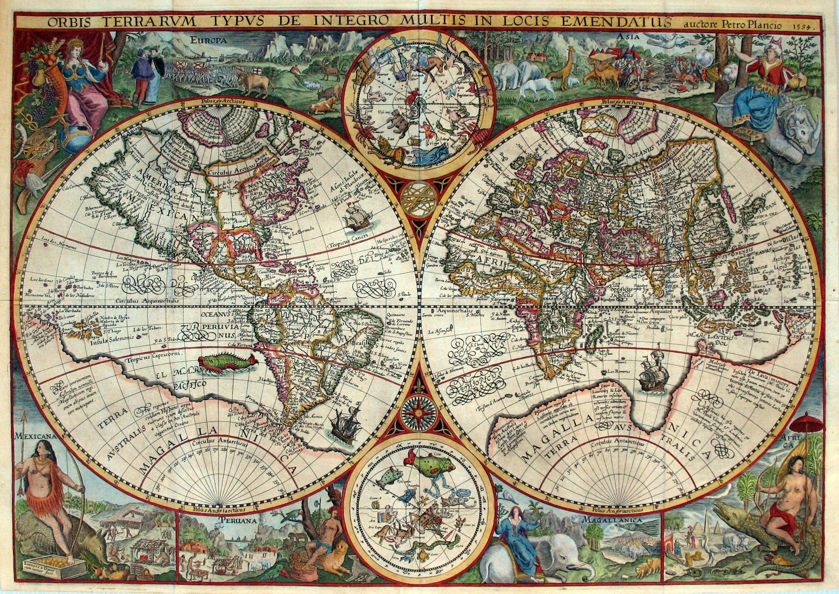
In 1592, Plancius became famous as a map maker with an elaborate world map called Nova et exacta Terrarum Tabula geographica et hydrographica.
As a decorative element, the map contained two planispheres of the northern and southern celestial hemispheres. In each, Plancius inserted a constellation of his
own design.
In 1598, Plancius was the first to display all twelve constellations developed by the
Dutch navigators on a globe.
Plancius remained active as a cartographer and globe maker.
|
 Crux and Triangulus Antarcticus on the 1589 globe
Source: Royal Museum Greenwitch
|
| Click the icons for detailed descriptions of the constellations. |
 Apes Bees |
 Camelopardalis Giraffe |
 Cancer Minor Lesser Crab |
 Columba Dove |
 Crux Southern Cross |
 Gallus Rooster |
 Jordanis Jordan River |
 Monoceros Unicorn |
 Polophylax Guardian of the Pole |
 Sagitta Australis Southern Arrow |
 Tigris Tigris River |
 Triangulus Antarcticus Antarctic Triangle |
|
Back to Star Lore |
Back to Mythology |
Back to Space Page |
Back to English |
 Back to Start Page |
